
The vision of a forest zone regrowth after a fire stuns and surprises us. Given the severity of vegetation and soil burn in the Rim Fire zone, we expect its regrowth patterns to educate everyone on the organic regeneration of the Tuolumne River Watershed – How quickly will it come back? What species were affected? How will it look during rain events? What level of erosion has occurred? The forest in the watershed burnt differently in different areas and our project will document the regrowth of the Rim Fire.
Wholly H2O, The Stanislaus National Forest Service, and Nerds For Nature banded together to set up crowd-sourcing photo sites throughout fire impacted areas in the Stanislaus National Forest.
As you are hiking through the forest, stop, place your camera in the site stand, snap a shot and upload it to Twitter, Instagram, or Flickr using the hashtag indicated on the sign (Example, #rimfire01, #rimfire02).
Click one of the tabs above to see photos of the recover from all over the watershed.
Learn More about the Tuolumne River Watershed and the Rim Fire.Interested in the data we're collecting? Here's the Google Spreadsheet.
The Rim Fire charred more acreage in the Sierra Nevada than any wildfire in recorded history. On August 17th, 2013, an illegal campfire gone wild was started by a hunter and burned for over 3 months through parts of Yosemite National Park and the Stanislaus National Forest; primarily in the Tuolumne River's watershed
Within a few short weeks, the Rim Fire scorched through 257,314 acres − or 402 square miles − an area roughly 8 times the size of the City of San Francisco. The effort took over 5,000 firefighters and an estimated $127 million to contain.
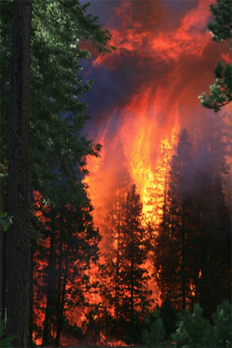
Near Camp Mather. Photo by Clint Gould, USFS
Watch the second by second growth of the Rim Fire Blaze here:
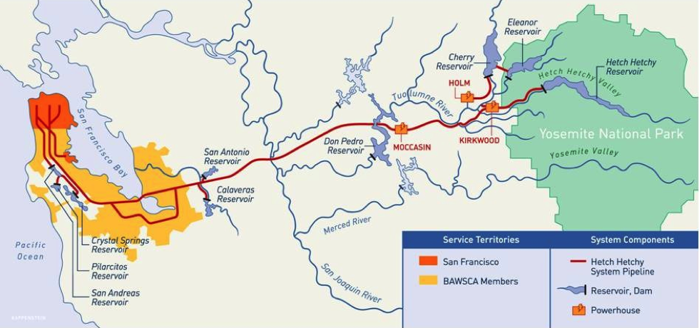
The Tuolumne River is the water supply for San Francisco and numerous other cities in the Bay Area, as well as the Turlock and Modesto Irrigation Districts.
Water agencies sell the Tuolumne River's water and electricity to over 2.6 million people and businesses in the San Francisco Bay Area, as well as to farmers for agricultural irrigation water in the Central Valley.
The Rim Fire will continue to have impacts in this watershed for many years to come. Monitor Change: Rim Fire will assist in documenting the ecosystem's recovery.